Thursday, May 19, 2016

A Rainy Day on Tom, Field, and Willey, 5/15/2016

3,400 feet of elevation gain
Avalon Trail, A-Z Trail, Mt. Tom Spur, Willey Range Trail
10 miles

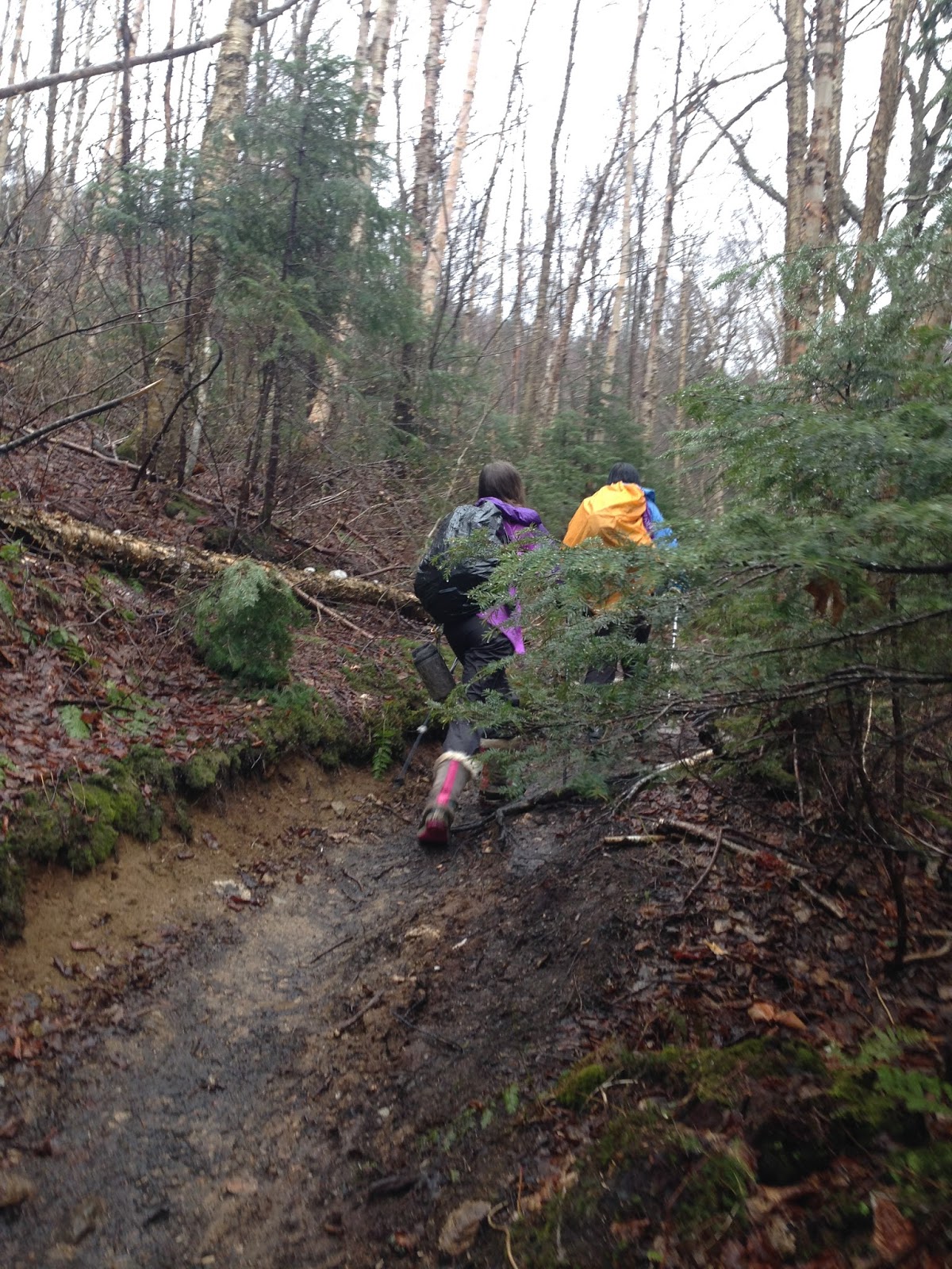
We started off with a wet and rainy day ahead of us.  Dressed in our rain pants and rain jackets, we were all set to hike.  Sage and I recently got new rain coats and wore them for the first time on this hike.  Sage have a purple rain jacket and I have a blue/green one.  The whole time it was either raining or sleeting.  When we got down low it was raining, but higher up on the peak it was sleeting.  A wet, wet, wet day!


Starting off...


The first major river crossing.  Sage and I each took turns demonstrating our judgment skills by determining the best way to cross based on the water depth and rapidity.  Sage did this one.  Here she is talking to Mom.


Continuing on...


Here is another crossing...
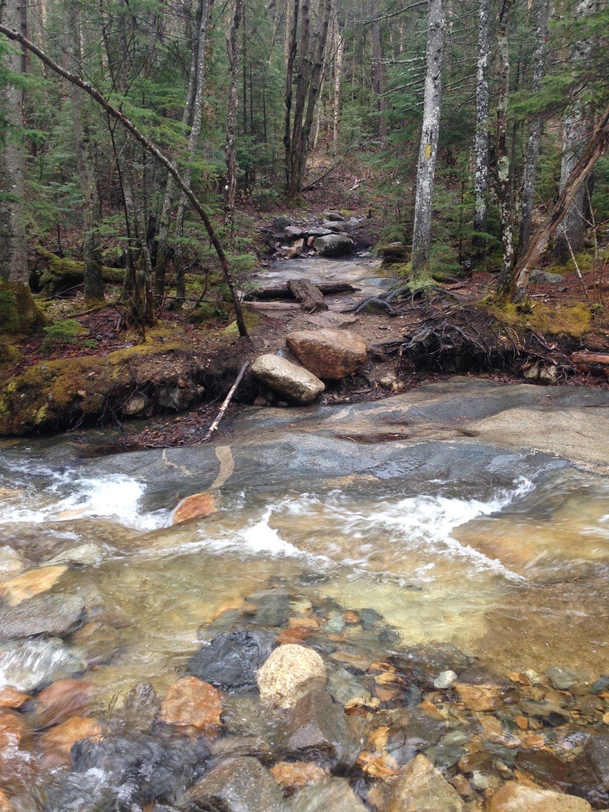


Moving on...


We heard about a man who, when this part was covered in snow and ice, slipped and fell all the way down and into the water below.


More crossings...we unbuckled our backpack straps so that if we got stuck, we could easily tear ourselves free and wouldn't have to worry about our backpack holding us down in the water.


Trees are looking snowy...


Here we are at the Mt. Tom Spur.  Such a beautiful place.  Memories of when I was younger on Mt. Tom flashed through my mind.


Here we are on the summit.  I tried to take a picture of a gray jay.  It is on a tree branch in the photo below.


Mt. Tom summit picture!


After that we bopped on over to Mt. Field.  Here is the Mt. Field summit photo...


On our way over to Mt. Willey, Mom noticed the snow-covered plants alongside the trail resembled flowering bushes.


Sage is talking to me as I take a photo...


Mt. Willey summit shot!


During different parts of the hike, there was a stable monorail of snow in the middle of the trail.


We hiked near Mt. Avalon on the way back.  Looking at clouds.


That's the end of our cloudy and wet loop hike.

Thursday, May 12, 2016

Hancocks and Upcoming Finals--May 9, 2016

Hancock Notch, Cedar Brook, and Hancock Loop Trails
2,650 feet of elevation gain
9.8 miles round-trip

It was colder than I expected.  Some of the recent hikes I have done have felt cool, warm, or even hot.  This one, however, was chillier.

I had a final for one of my courses coming up, so that was lingering on my mind.


Off we go...with the bridges at the very beginning.


There are many water crossings on the Hancocks.  We had to be careful on them so that we didn't fall in or slip.


A little snow and ice appeared here.


An intersection!


Mom crossing a water crossing.  It was better to walk on the rocks that were underneath the surface of the still water than to walk on the rocks right next to the rushing water.


The second intersection!  We usually go up North Hancock first and then go over to South Hancock and down, but today we did something a little different.  We had heard that the ice going up South Hancock was pretty strenuous, so we decided to go up South Hancock first instead and then traverse over to North Hancock and down.  This was because it is usually easier and safer to go up ice than down it.


Here comes the ice and snow...


North Hancock in the distance...


Almost at the top of South Hancock.  The summit is straight through the trees up there.


There it is!  Sage has sat down to rest.


I focused my iPhone camera on the sky and clouds.  They are bright and colorful.


 Heading over to North Hancock...the ice and snow was there, but not as bad as the hike up South Hancock.


Here we are at the summit of North Hancock!


On the way down, before the intersection separating the trail up North Hancock and South Hancock, we came across a water crossing that is usually dry.  Sage pointed out that this would be a beautiful image to take.


 The end of the trail is right up there.  The hike has ended!


Thursday, May 5, 2016

Jackson, May 1, 2016

5.2 miles round-trip
2,150 feet of elevation gain

When Mom, Sage, and I, it was slightly chilly but not very cold.  I could feel springtime in the air as I crossed the street and walked along the growing grass to the trail sign.


Some of the plants along the trail appeared not quite alive yet.  Also, the trees had not gotten back their leaves.


The distinguishable blue blaze marking the path...Sage in the background.


Thin tree serving as something to walk under, stretching across the path. 


A water crossing--you don't see the water in this picture.  The water is there, though, between Sage and the large slab of rock.


About halfway done!  We arrived at the intersection.  The temperature was still comfortable.


Continuing along the trail...pole in the picture as usual.


We found a kid's glove on top of a small tree (shown in the image).  It looked as though someone hung it there after seeing it somewhere else--perhaps on the ground.


A little ice showed itself--not so bad though.


Okay...here we put on traction.  It became apparent that the trail was too slippery to get away with  bare boots.


I was happy to get above treeline!  There wasn't ice on the rock up there, so that was good.  We took our traction off at this point, as to not ruin the blades.

Here is the sign.


We traveled to the summit and sat down for a while.  It felt good to take a break without getting cold right away...Washington in the distance.


My attempted zoomed photo of Mizpah Hut.  Not a perfect picture...


Mom found another lost item.  This time it was a light blue washcloth, as shown in this image.


I enjoyed my snack up there.


It was odd, because I didn't see any gray jays.  I saw a different kind of bird, though.  It was smaller than the previous gray jays, but it was similarly colored.  Joking around, we wondered if they "ate the gray jays."


When we finished eating and started heading back down, we met this nice couple.  The mother had a baby strapped to her back.  I was happy to see a young person in the mountains!

'Til next week...and I hope to see some of you at Beech Hill Farm this Friday!